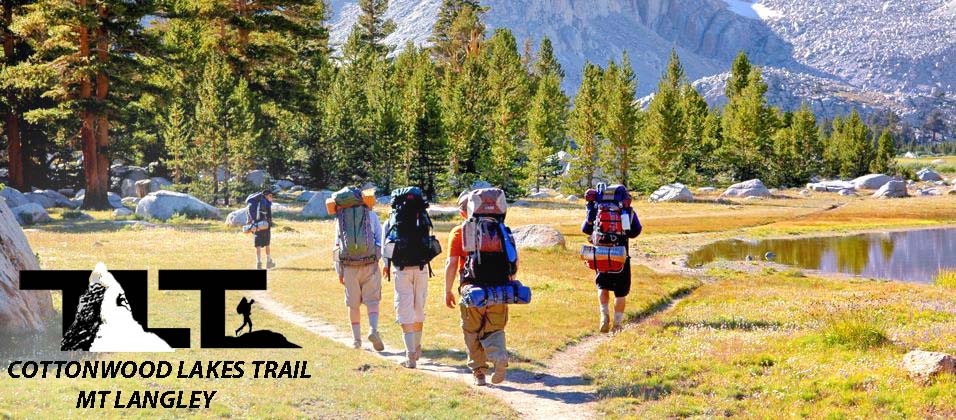
The Cottonwood Lakes Trail gives you easy access to Mt Langley. It begins at the Horseshoe Meadow parking lot at an elevation of 10,000 feet. You get a nice high start, and the trail is excellent. It starts off fairly level then descends a bit to the golden trout camp area. Here the trail runs level for a while and then climbs out of the basin to the Cottonwood Lakes area. Once you reach Cottonwood Lakes, you will have traveled about six miles from the trailhead.
But before you get to Cottonwood Lakes, you will see a sign reading New Army Pass. Do not take this option or you will miss out on Cottonwood Lakes. Once in the Lakes basin, the imposing south face of Mt Langley comes into view. The above mentioned lakes are a beautiful place to set up camp if you are planning on spending more than a day on Mt Langley. From the lakes basin, follow the trail and and it will take you up a short climb into a smaller lake basin. From there you will travel up a steep section known as Old Army Pass. At the top of the pass, you will enter into Sequoia National Park. You are now well above timberline, and the unmaintained trail is easy to follow. You are almost there, and with a bit more hiking and scrambling you will be able to reach the summit (14,042 Ft). The summit is 10.5 miles from the trailhead with an elevation gain of 4,002 Feet. This is a short summary of what you will encounter on the Cottonwood Lakes trail and the Old Army Pass that leads to the Summit of Mt Langley. For more detail and photos on your approach to the summit of Mt Langley, see below.
 Mt Langley/Cottonwood Lakes Topo Map used with permission from National Geographic
In the above map, you can see the brighter red line that represents the (Cottonwood Lakes/Army Pass) Trail. The first 6 1/2 miles of trail is well maintained, while the last 4 miles is an unmaintained but well worn foot path. The last 300 vertical feet must be gained by scrambling up class two rock to the summit.
Mt Langley/Cottonwood Lakes Topo Map used with permission from National Geographic
In the above map, you can see the brighter red line that represents the (Cottonwood Lakes/Army Pass) Trail. The first 6 1/2 miles of trail is well maintained, while the last 4 miles is an unmaintained but well worn foot path. The last 300 vertical feet must be gained by scrambling up class two rock to the summit.As noted in the contour lines, the trail starts out gentle, then switchbacks up after a few miles into the cottonwood lakes basin. From there the trail levels out again as it passes through the beautiful meadows and Cottonwood Lakes.
Once past Lake 5, as labeled in the map (but posts a sign labeled Lake 4 on the actual trail), things begin to turn steep. This is part of the unmaintained trail that leads to Old Army Pass. Lots of switchbacks are encountered as it climbs what seems to be a cliff when viewed from below.
I found this section of trail perfectly do-able, and even a little bit exciting. Once you climb out of the basin the trail gives you a super vantage point and you will be treated to some wonderful scenic views of the lakes and meadows below.
 Mid July or August is a good time to climb Mt Langley, even though you may encounter hot dusty conditions down low on the trail (as seen to the right). Earlier in the year would be better for the lower sections of the trail but the downside to this would be lots of snow and ice on the trail that goes from Cottonwood Lakes Basin to Old Army Pass.
The way around this would be to carry and use an ice ax and crampons to gain the pass. But you will need to be skilled in this type of travel in order to negotiate the more difficult terrain.
The dusty conditions are short lived, because it will not be long before you will begin to gain altitude on the up and coming switchbacks, and you will soon enter into the beautiful Cottonwood Lakes district that sports wonderfully green meadows and crystal clear lakes.

Not too far from the trailhead, you will come to a sign notifying you that you are entering the John Muir Wilderness. The John Muir Wilderness is a wilderness area that extends along the crest of the Sierra Nevada of California, USA. It runs for 90 miles along the High Sierra crest, and contains 581,000 acres.
The John Muir Wilderness was established in 1964 by the Wilderness Act and named for naturalist John Muir. The wilderness begins near Mammoth Lakes to the north, and ends in the Cottonwood Lakes area to the south.
I have come across several of these signs in my travels throughout the Sierra Nevada, but this marker is something special, because it marks the southernmost boundary of the John Muir Wilderness. This very special wilderness area is home to some of the most beautiful mountain scenery in all the world.
 In the photograph (on the
left
above left
hand side) you will see one of the log crossings that you will encounter on the lower sections of the Cottonwood Lakes Army Pass trail. I find these crossings are kind of fun, and you get a chance to practice your balance a bit. The streams in the Cottonwood lakes area travel at a gentle pace here, and the height of the crossing is certainly not too fearful. You still don't want to take a fall. Even short falls can result in sprained ankles or even worse types of injuries.
In the photograph (on the
left
above left
hand side) you will see one of the log crossings that you will encounter on the lower sections of the Cottonwood Lakes Army Pass trail. I find these crossings are kind of fun, and you get a chance to practice your balance a bit. The streams in the Cottonwood lakes area travel at a gentle pace here, and the height of the crossing is certainly not too fearful. You still don't want to take a fall. Even short falls can result in sprained ankles or even worse types of injuries.
The lakes are a good place to get water, but you still need to filter, chemically treat, or boil it for safety. Cottonwood Lakes gets a lot of visitors, and it is not worth taking a chance in heavily populated areas to not treat your water supply. For much more on this subject, please visit our page on Water/Dehydration.
 In the image
to the left
above
is an image of the beautiful meadows and lakes that make up the Cottonwood Lakes Basin. You also get your first clear view of Mt Langley as you gain access to this area from the trail below. There are few places in the Sierra Nevada that offer such unspoiled large scale high altitude meadows.
In the image
to the left
above
is an image of the beautiful meadows and lakes that make up the Cottonwood Lakes Basin. You also get your first clear view of Mt Langley as you gain access to this area from the trail below. There are few places in the Sierra Nevada that offer such unspoiled large scale high altitude meadows.You are now at 11,000 feet above sea level, and the trees are beginning to thin out. Timberline is at approximately 12,000 feet in the Southern Sierra, and as you can see in the photo to the left, you only have a bit more elevation to gain before you will be working up barren rock that leads to Old Army Pass.
The lakes basin is also a great place for landscape photography. Early morning lighting provides wonderful opportunities for photographers. The water surfaces are usually very still during this time of day, and you can get beautiful photos of Mt Langley reflected in the clear calm waters below. Many people call it a day at this point and hang out and enjoy the area and possibly do a little fishing. But for us, the basin was a great place to camp before pushing on to the summit of Mt Langley.
 In the above photo to the left, you see Lake 2 in the early evening hours. Just above, you see an image of what you will see when you first gain access to the meadows area.
The peak in the upper left hand portion of the picture is Cirque Peak. Cirque tops out at 12,900 feet, and many mistake it for Mt Langley.
In the above photo to the left, you see Lake 2 in the early evening hours. Just above, you see an image of what you will see when you first gain access to the meadows area.
The peak in the upper left hand portion of the picture is Cirque Peak. Cirque tops out at 12,900 feet, and many mistake it for Mt Langley.I have heard of, and known of, hikers and climbers who have climbed Cirque Peak instead of their intended goal of Mt Langley. Needless to say, they were very disappointed. They might of rested up a day or so and then gone back and climbed Mt Langley the next day. But those I have spoken to say that they were out of time and energy and would have to come back and give Mount Langley a try some other time in the future.
 In the image
to the left,
above,
you can see hikers returning to Lake 3 where they are camped after doing a bit of fishing in the lakes higher up.
In the image
to the left,
above,
you can see hikers returning to Lake 3 where they are camped after doing a bit of fishing in the lakes higher up. The small lakes along the Cottonwoods basin provide great fishing but there is a catch and release rule so don't count on a fresh fish dinner on this particular adventure. But needless to say the challenge of catching a fish under any circumstances provides a reward all its own. I am not a fisherman, so for me it's just nice to be around water for multiple reasons.
 In the photograph to the right, you see Lake 4 in the distance along with the headwall that guards Old Army Pass from easy entry. When looking at it from this vantage point, it does not seem possible that there is a trail that leads up to the pass that is located in the center of this view where ground meets sky. Other than at the very end of the trail where you will need to do a bit of rock scrambling, the pathway above lake 4 is the steepest part of the trail.
The unmaintained trail to the pass seems impenetrable at first, but with an hour or two of hard work (and a little excitement) the pass will be gained, and you will find yourself closing in on the summit of Mount Langley.
 Just above, you see the lower section of the Old Army Pass trail. You are now above timberline and things are very stark and rocky up here. In the above photo to the right, you see the remnants of snow left over from the winter months, causing the hikers to skirt along the edge of the trail.
 In the above photos to the left and right, it seem like the hikers are engaging in a full on climb through boulders.
The trail was still pretty clear here though, and it really wasn't that bad. I thought this was a really cool section of the trail to negotiate, and it gives one a feeling of real high altitude climbing even though you are technically still on the trail.
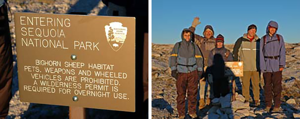 When you reach the top of Old Army Pass (12,000 Feet), you are greeted with a trail marker (as shown on the left) letting you know that you are now entering Sequoia National Park. This is just like the one on the Mt Whitney Trail located at Trail Crest. But there you enter Sequoia National Park at 13,600 Ft.
To the right you see the group taking advantage of a photo-opp at the top of the Old Army Pass
When you reach the top of Old Army Pass (12,000 Feet), you are greeted with a trail marker (as shown on the left) letting you know that you are now entering Sequoia National Park. This is just like the one on the Mt Whitney Trail located at Trail Crest. But there you enter Sequoia National Park at 13,600 Ft.
To the right you see the group taking advantage of a photo-opp at the top of the Old Army Pass
 Now that you have gained the pass, the trail eases up and you will now traverse along one of the High Sierra crest lines. Even though the trail is not as steep as what you have just encountered, there is still a little over 2,000 vertical feet to gain before reaching your goal. Air is a lot thinner up here and you will have to make good use of your remaining energy reserves to reach the summit.
The views from the crest are fantastic, and you can see clear into the Owens Valley to the east (which is over 8,000 feet below the pass), and into Sequoia National Park to the west.
 In the above left hand photo you can see a hiker enjoying the well earned view that stretches far into the distance below. I could not resist getting this image of Russ taking a break just below the summit block of Mt Langley. He certainly knows how to make the best of stark conditions and get some rest. He even makes use of the surrounding natural materials for making a nice little pillow to lay his head on. In the above image to the right you see the group taking in the view of Sequoia National Park to the west. Even though we are actually standing within the boundaries of Sequoia, the heavily populated portion of the park lies far below.
 The trail finally ends and those wanting to reach the summit must scramble up the last 300 vertical feet of class 2 rock before reaching the top of Mount Langley.
As you can see in the three photos to the left, above, there are lots of good sized boulders to scramble over, but hand holds are plentiful.
But care still must be taken. A fall could produce serious injury, and there is always the danger of rocks being kicked loose and sent your way. Therefore, be careful not only for yourself but for all those who follow. Rockfall from climbers above is one of the most common problems when it comes to injuries and even death in the mountains.
Well, that concludes our section on the Cottonwood Lakes Army Pass Trail up Mount Langley. For much more on Mt Langley please use the above menu for more info on Mt Langley. Email Sign Up

|
Join the Adventure! Sign up here for Timberline Trails Monthly Newsletter |

Join us on Instagram
©2006-2026 TimberlineTrails. All Rights Reserved.
....