 The Trail that follows the North Fork of Big Pine Creek - provides access to some of the finest scenery in all of the Sierra Nevada.
It will follow a series of lakes and meadows along with impressive grandeur that will delight just about every outdoor enthusiast, and because of this fact, it is a very popular trail for backcountry hikers, backpackers, fisherman, and mountaineers. Permits are very limited to 25 people per day (15 can be reserved 6 months in advance and 10 are available that can be reserved 2 weeks in advance). This makes things difficult for those who want to explore this area of the Sierra so plan accordingly. It is also the a great approach path for climbing the North Palisade, Mt Sill, and other peaks that border the Palisade Glacier.
The Trail that follows the North Fork of Big Pine Creek - provides access to some of the finest scenery in all of the Sierra Nevada.
It will follow a series of lakes and meadows along with impressive grandeur that will delight just about every outdoor enthusiast, and because of this fact, it is a very popular trail for backcountry hikers, backpackers, fisherman, and mountaineers. Permits are very limited to 25 people per day (15 can be reserved 6 months in advance and 10 are available that can be reserved 2 weeks in advance). This makes things difficult for those who want to explore this area of the Sierra so plan accordingly. It is also the a great approach path for climbing the North Palisade, Mt Sill, and other peaks that border the Palisade Glacier.
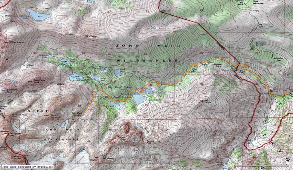 Above you see a map showing the route (in orange) going up the North Fork of Big Pine Creek starting at the Glacier Lodge Area Parking Lot, and then traveling up to Sam Mack Meadow where it ends. For our purpose of climbing in the Palisades we traveled by Lakes 1-3, but if you are backpacking or just on a long day hike, you can see the dotted line (if you look carefully) leading to Black Lake, and Lakes 4-7.
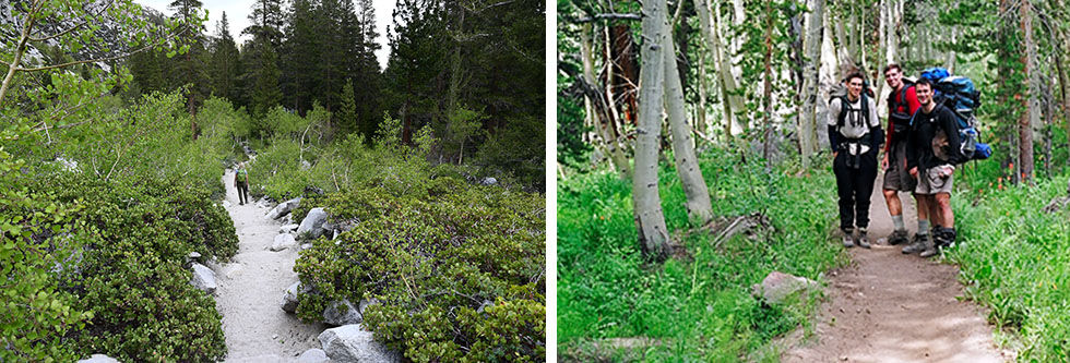
As you can see in the photo above, the trail starts out in desert like conditions, and this goes on for the first mile or two depending on the time of year.
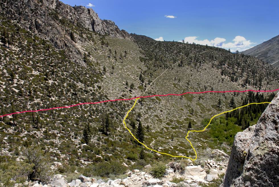
Once you reach the Trailhead, you have a couple of options. There is a day hikers parking lot (7,814 ft) a bit up the road from the first Trailhead parking lot that is there for day use only (you are not allowed to park there overnight). This parking area is useful for dropping off others in your group (along with yours and their packs) and it will save about a mile and a half on the trail which we found helpful. This way only the driver has to hike back up the road and meet up with your group, and can do so without having to carry his or her pack. But both the overnight and day hikers trail options will come together later on (not that far up the slope). This makes both options totally workable. In the above photo, the red line shows the trail coming from the overnight parking lot, and the yellow line shows the trail coming from the hikers day use parking area. As stated, taking the yellow line trail (Hikers Trailhead) vs the red line trail (Overnight Parking Trailhead (7,700 ft) saves about a mile and a half of hiking.
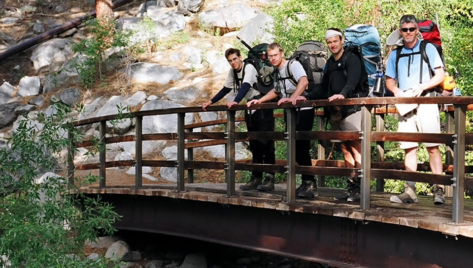 Above you see our group on the bridge that crosses over the roaring Big Pine Creek in early season. You will encounter the bridge very early on (about 0.25 miles) after starting up the Trail from the day use parking area.
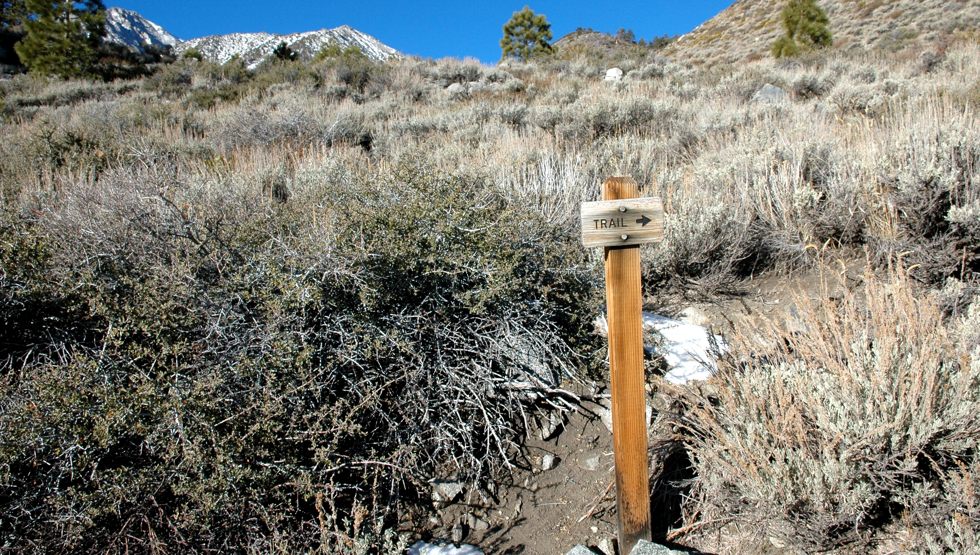
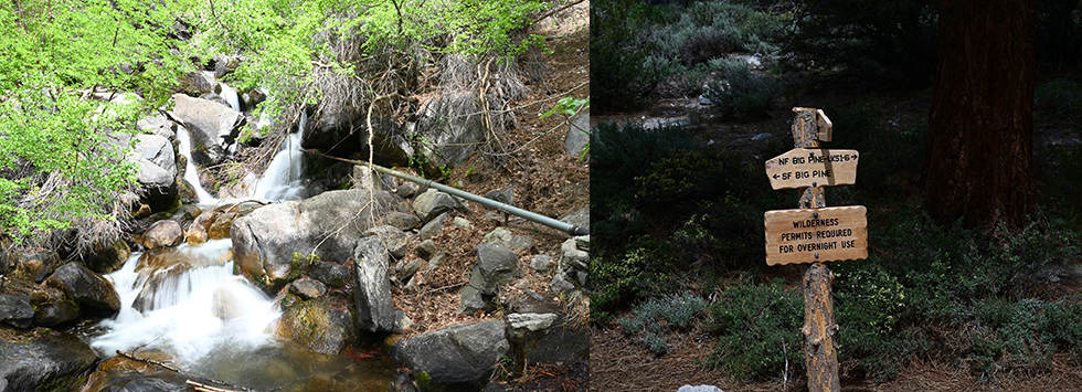 In the image above left you see the cascading creek as it descends into the valley below. Then shortly after crossing the bridge you will see a trail sign shown above right. Make sure to take the NF option lakes 1-6 to continue up the North Fork Trail.
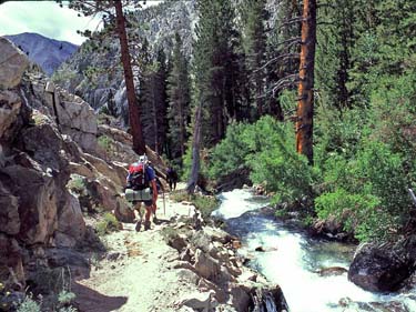 From there you will wind through the lower portion of the North Fork along the water way (
shown to the left
above
). At about the 0.7 mile point (at a flat section with wooden posts) you will make a right hand turn and cross over a small bridge. You are now at approx 8,200 feet in elevation. Very shortly on from there, you will see a sign that gives you a choice of the Upper or Lower Trail that will eventually connect to the Overnight Parking area route.
From there you will wind through the lower portion of the North Fork along the water way (
shown to the left
above
). At about the 0.7 mile point (at a flat section with wooden posts) you will make a right hand turn and cross over a small bridge. You are now at approx 8,200 feet in elevation. Very shortly on from there, you will see a sign that gives you a choice of the Upper or Lower Trail that will eventually connect to the Overnight Parking area route.
We choose the Lower Trail option that is a bit gentler than the upper route. Both eventually require a steeper set of switch backs that will then will join up with the upper trail.
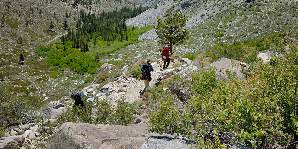 In the photo above, you can see both the Lower Trail and the Upper Overnight trails. The hikers shown in the image are near the upper trail connection.
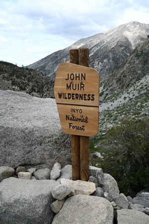 Next you come to a sign at the 2 mile point (8,825 ft) letting you know that you are entering "The John Muir Wilderness" area. It was designated by Congress in 1964 to be preserved as an area where people are considered as visitors only. The Act's purpose is to preserve and protect the natural ecosystems and wild areas and provide opportunities observing the beauty and create solitude for current and future generations to enjoy. It covers 650,000 acres. The wilderness was named in honor of John Muir. Inyo National Forest and Sierra National Forest share management responsibility for the John Muir Wilderness. Approximately 299,000 Acres (46%) of its 650,000 acres is managed by INF.
It is contiguous with Kings Canyon and Sequoia National Parks, Ansel Adams Wilderness, Golden Trout Wilderness and several other wilderness areas in the Sierra Nevada. Together, they constitute one of the largest roadless areas in the lower 48 states and certainly the largest in California. The John Muir Wilderness is very heavily used due to the fact that approximately 30 million people live within a few hours drive. So needless to say, the area is well regulated requiring permits for all overnight stays within its borders.
As you proceed, it will not be long until you proceed through a manzanita grove (lower left image) and then to be followed up by a section of beautiful aspen trees (below right)
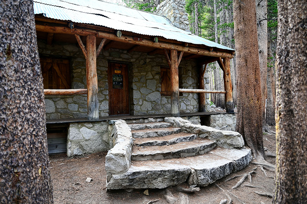
 In about 0.7 miles from the John Muir Wilderness Sign, you will come across Lon Chaney's cabin (photo below). It is located at the 2.7 mile point from the Trailhead and sits at an elevation of 9,200 ft. Lon Chaney was a silent film actor from the 1920's. In 1929 he hired a famous architect of the time named Paul Revere Williams to build the cabin. He used it as a family getaway during the summer months. Lon Chaney loved to fish in the mountains, and he didn't have to go far, because just a bit down slope from his front steps lies the Big Pine Creek. Unfortunately and sadly, he was only able to enjoy it for a very short while due to the fact that he passed away only a few months after construction was completed.
In 1964 the location became part of he John Muir Wilderness and the special permit for the cabin expired in 1980. The structure then reverted to government ownership in that year. Lon Chaney was considered a powerful actor and makeup artist and was known for his characterization of tortured, troubled, and afflicted characters. Some of his most memorable films were Phantom of the Opera, Quasimodo in the Hunchback of Notre Dame, Fagan in Oliver Twist, Blind Pew in Treasure Island and many others. Lon Chaney was born on April 1st 1883, and died young at 47 years old on August 26th 1930. The cabin is now registered as a Historic Landmark.
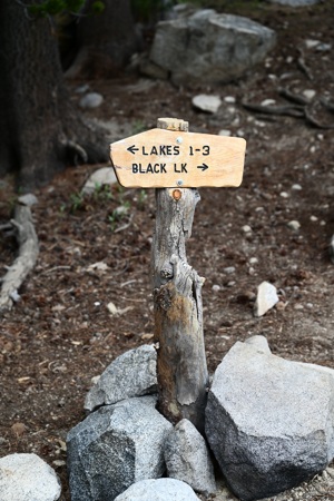 After leaving Lon Chaney's Cabin and heading up the trail, you will come to a sign pointing the way to Lakes 1-3 and Black Lake.
Most people continue to 1st lake and beyond. But for the purposes of climbing in the Palisades, I believe the 1-3 Lakes option is the best way to go. We always use this approach when climbing Mt Sill or North Palisade. It is also the best approach for reaching the Palisade Glacier or Sam Mack Meadow, if that is your goal.
Others, will use the Black Lake option which is a nice way to go if you are going to do a loop trail and come back through Lakes 1-3 on the way down. It is also not a bad way to go to reach the upper lakes 5-7.
Fourth Lake is at the 6.5 10,700 feet, Fifth Lake 6.8 miles 10,750 feet, Sixth Lake 8.0 miles 11,050 feet, and lastly Seventh Lake 8.5 miles 11,150 feet. I think this is a great way to go if you are backpacking or if you are a day hiker with plenty of energy to complete the loop and return to the Trailhead in a days time.
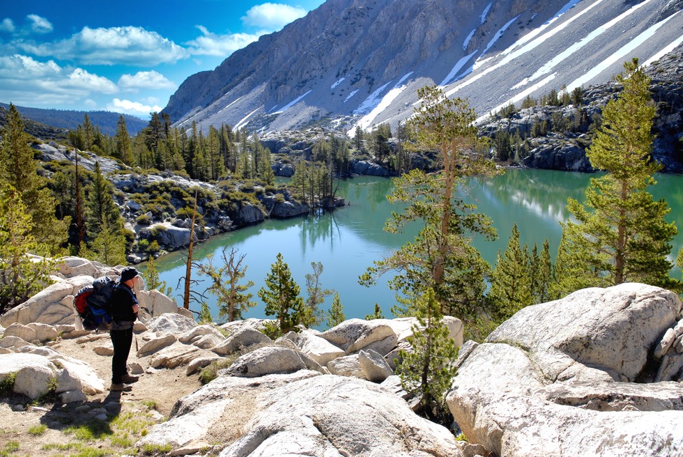
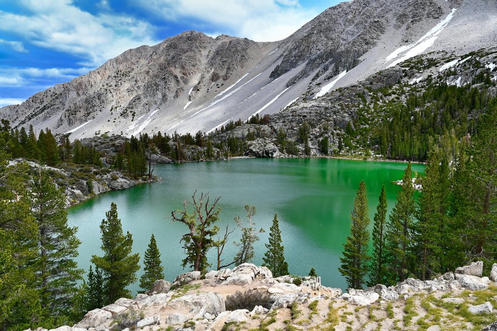 Above you see an image of Bishop First Lake located at the 5 mile (10,038 ft) point of your hike. Notice the nice green color. This is the result of the Palisade Glacier above that functions like a bulldozer, grinding away and pulverizing rocks as it moves down the mountain. The process produces a fine-grained powder of silt and clay known as glacial flour which is picked up by melt water streams that flow into these lower lakes. Since the particles are so fine, they are slow to sink to the bottom and will remain suspended in the water column instead. When sunlight hits the water, the particles will absorb the shortest wavelengths such as the purples and indigos but the water in the lake will absorb the longer wavelength such as the reds, oranges, and yellows that combine to leave mainly the blues and greens which are reflected back into our eyes. In any case, it produces a beautiful scene and is a great place to camp, have lunch or a snack, or just hang out for a bit.
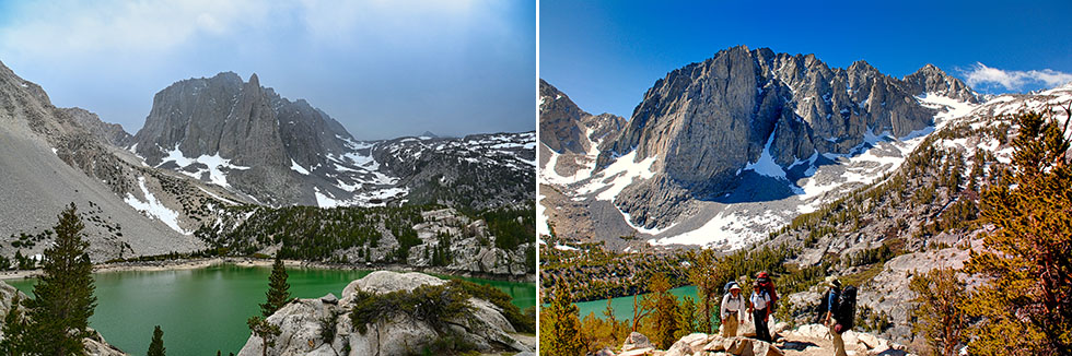 Then very shortly after 1st Lake (image above left), you will come to 2nd Lake located 5.1 miles from the hikers Trailhead. You are now at 10,140 ft elevation. This is another beautiful lake with Temple Craig rising up to 12,982 feet (2,842 feet above 2nd lake) in the background. Temple Craig is a destination for many rock climbers due to its impressing rock face and the many challenges it presents climbers.
Then in the above right hand photo, you see 3rd Lake. It is 0.4 miles beyond 2nd Lake at the 5.5 mile mark at 10,282 feet. It also is a great place to camp and has a very similar view of Temple Craig in the background and is a favorite destination for many backpackers, fisherman, climbers, and day hikers alike.
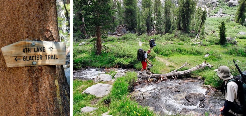 Once past Third Lake, you will continue on for about 0.6 miles (6.1 miles from Trailhead 10,582ft) and you will see a fork in the trail with a sign (shown in the upper left hand image) giving you the choice of going up to 4th Lake or taking the Glacier Trail. Because our ultimate goal is to climb either North Palisade, Mt Sill, or Polemonium Peak (all 14ers) we took the Glacier Trail option. It also is the obvious choice if your goal is to camp at Sam Mack Meadow or visit the Palisade Glacier. There are many other climbing possibilities up higher, but for other 14ers such as Thunderbolt and Starlight peak, I think the Bishop Pass Trail (out of the town of Bishop), works better.
Once past the sign above left, you will come to a pretty little meadow with a couple of stream crossings (photo above right). This is also a good place to camp. But if you are in early season just after the melt off, it can be a terrible place due to the multitudes of mosquitoes that hatch in the soggy bogs of the meadow. Because we usually climb in the Palisades just after the melt off, at this point in the trail, we nicknamed this meadow "Mosquito Meadow" and quickly move up to higher ground.
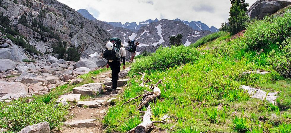 After leaving the meadow, you will switch back up a moderate slope for about 0.9 Miles and an elevation gain of 461 feet from the meadow to get to Sam Mack Meadow.
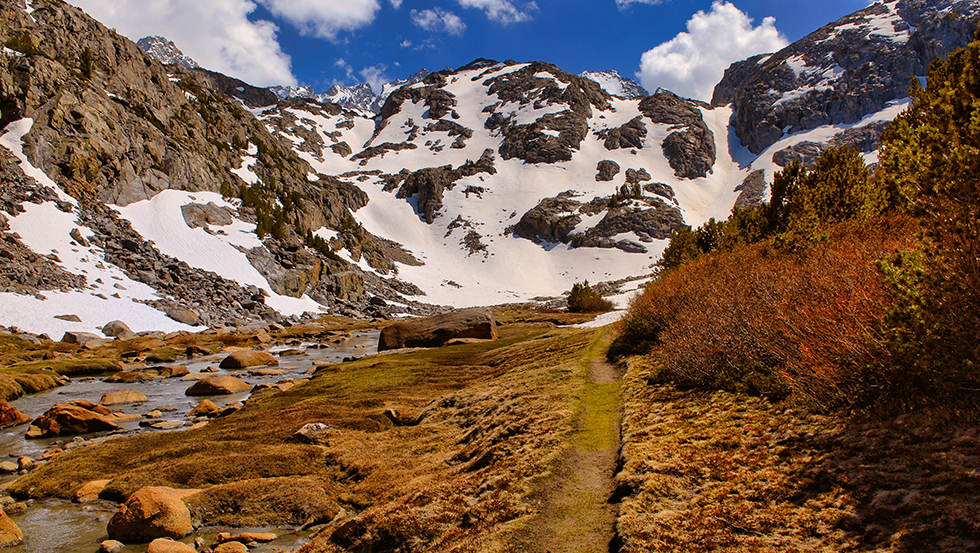 Sam Mack Meadow (image above) is located at the 7.3 mile point and sits at 11,043 ft above sea level. It is a beautiful location and is a great place to camp. Just make sure to stay at least 100 feet from the year round stream that flows across the meadow. There are several places that you can camp away from the water and you will see several established sites. The meadow which is close to the water is very boggy, so take care to have as minimal impact on this fragile terrain. Mosquitoes can be a problem here too, so make sure to keep your bug repellent handy!
Sam Mack Meadow is a great place to set up for several mountaineering routes in the Eastern Sierra. Mt Robinson is to your immediate north, and as you proceed upward, Mount Agassiz, Mount Winchell, and Thunderbolt Peak, Mount Gayley, Mount Sill, and the impressive site of the North Palisade will come into view.
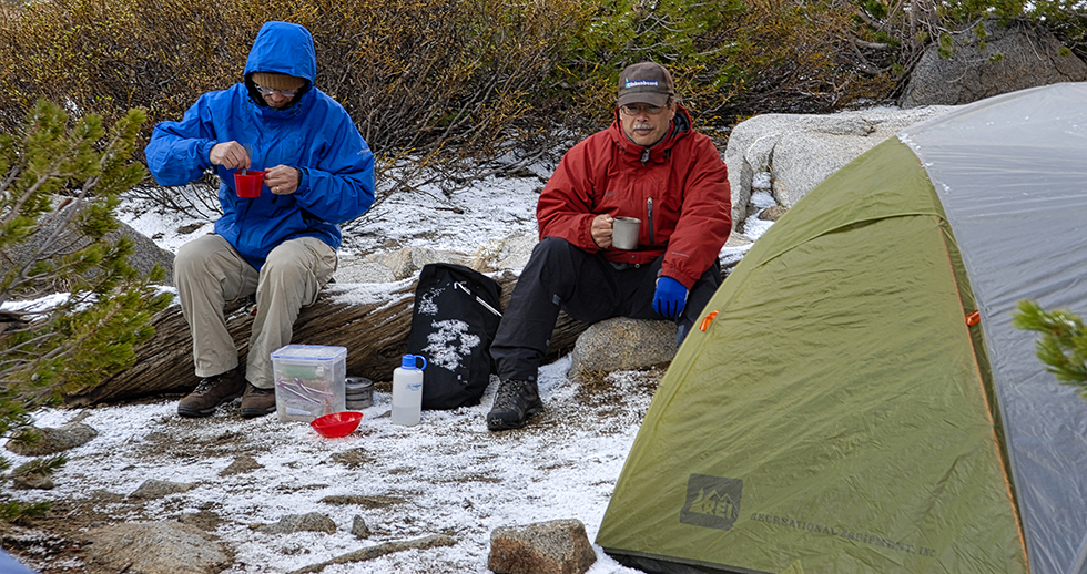 Above you see a photo of Larry and Wayne camping in Sam Mack Meadow. They were part of one of our mountaineering trips in the Palisade area. It snowed during the night, as you can see, and this made for a bit of fun the next day.
This finishes up our writeup on the North Fork of Big Pine Creek. There is a small trail on the other side of the stream that ends at the bottom of the glacier moraine but if you have crampons and ice ax (a must for climbing pretty much any of the Palisade Peaks) there is a better way (in my opinion) to reach the Palisade Glacier to prepare for your final climb. As mentioned before, we use the North Fork for climbs up Polemonium Peak, Mt Sill, and North Palisade.
Your ears shall hear a word behind you, saying, “This is the way, walk in it,” Whenever you turn to the right hand Or whenever you turn to the left.
Isaiah 30:21

| Join the Adventure! Sign up here for Timberline Trails Monthly Newsletter |

Join us on Instagram
©2006-2026 TimberlineTrails. All Rights Reserved.
....